Read more blog entries, posted by GreenTrACS.
From the April 24 post: A Dartmouth research team has begun an expedition in Greenland at the NSF deep field station Camp Raven in southwest Greenland and will travel 1,700 kilometers from Southwest Greenland to the summit of the ice cap. The team will use a variety of Boise State radar systems to track the subsurface snow layers, and will continuously measure the journey to the summit. The age of the layers will then be determined by a geochemistry analysis of 60-foot core sample sections of ice and snow. The research data gathered from each sample site allows for estimation on annual snowfall amounts dating back over 50 years.
(Keep track of where the researchers are with this interactive map.)
The Greenland field expedition is funded by a collaborative NSF Office of Polar Programs grant between Dartmouth and Boise State. The principal investigators from Dartmouth are Assistant Professor of Earth Sciences Erich Osterberg and Associate Professor of Earth Sciences Robert Hawley. With the professors in the field is Gabe Lewis, a second-year PhD student at Dartmouth who is focusing on the spatial and temporal variability of accumulation and albedo of the Greenland Ice Sheet. Boise State researchers are geoscientists H.P. Marshall and John Bradford. This trip to Greenland will include detailed core sample analysis and radar observations completing half the full traverse; a second trip will be completed next year.
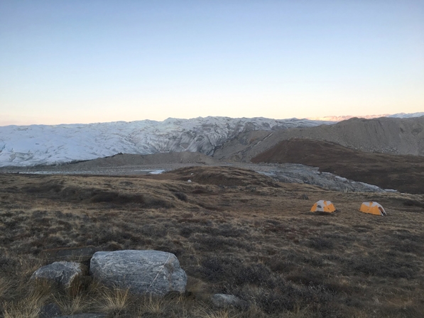
During the seven-week expedition, the research team will travel by snowmobile and live in tents. In addition to mapping new areas for measurement, they will also revisit multiple Program for Artic Regional Climate Assessment (PARCA) sites. PARCA was launched by NASA in 1993 with the primary goal of measuring and understanding the mass balance of the Greenland ice sheet.
The research continues previous work in Greenland conducted by Marshall and Bradford. Bradford’s radar inversion work completed with Boise State doctoral student Joel Brown and University of Montana glaciologist Joel Harper will be applied to the radar data collected during this research trip. Marshall conducted radar measurements in 2010 and built a radar system used for a traverse from the summit to Thule Air Base.
The research being conducted during this trip and the subsequent trip next year holds significant relevance for the future of the planet and research into climate change.
May 6 entry:
Quick update—science progress!
A few quick science updates from Erich (Osterberg) in the field:
They has a great day yesterday, drilling to 20 meters smoothly, and running radar out to 30 km to the east of camp 1. They also ran the FMCW and multi-offset radars in a pattern around the core site, to characterize the site. At the farthest point east, they measured albedo and density in a shallow pit, and returned following an Operation IceBridge flight line (different from the one they followed on the way out).
Today, they plan to deepen the core to 30 meters, and run all of the radars to the west (as I type I see they are close to 30 km to the west).
Erich’s closing message sums up how the team feels a few days into the traverse, having worked out some of the kinks of traveling with thousands of pounds of gear and trying to collect data with delicate instruments:
“Feel like we have our feet under us.”
Well said. Stay tuned—keep an eye on the breadcrumb trackers to watch where our team goes!